Goldie Creek
Background
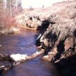
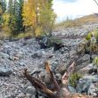
Goldie Creek is a tributary of Stoney Creek which is a tributary of the Nechako River. Like Stoney Creek, Goldie Creek has been severely impacted by historical land use practices, including agriculture. The area which proposed intense restoration activities occurred was historically impacted when Highway 27 was constructed 20-30 years ago. The fill from the excavation of the highway was placed along Goldie Creek. This fill was not sloped adequately, causing incision of the channel, combined with inadequate root structure contributed to major sloughing of this sediment into Goldie Creek as the stream eroded the toe of the slope. This erosion has contributed significant amounts of sediment into Stoney Creek and ultimately into the spawning beds of Nechako White Sturgeon just below the Stoney Creek/Nechako River confluence.
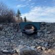
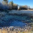
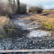
Goldie Creek has been severely impacted by historical land use practices, including agriculture. A stream crossing at this site had two incorrectly installed undersized culverts which where barriers to fish passage. Freshet waters would frequently flood around the culverts. Additionally, as waters slowed behind the culverts, sediments from erosion of agricultural fields during freshet would fall out of suspension depositing substantial amounts of sediment annually. These sediments accumulated over the many years causing the stream to became aggregated, undefined and ephemeral.
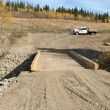
There is also a crossing where culverts have washed out several times, and the landowner is fording the stream to get to his land on the other side of the stream.
About the Goldie Creek Restoration - Healthy Watersheds Initiative 2021
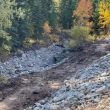
While the stream channel area was completely dry, a definable channel was excavated removing deposited sediments out and away from the stream, creating a channel that more effectively move water. Additionally, an open bottom arch bridge was installed at the crossing which provides year-round fish passage opportunity and allows water to move freely through the stream. Willow was also planted along the banks of the stream channel to help prevent erosion, increase bank stability, and provide shade, cover and habitat complexity at this site.
The restoration plan includes restoring the stream to its previous location, matching the existing elevation of the existing stream bed, using gravels/cobbles and appropriately place rock to add habitat complexity and minimize sediment transport, and adding LWD to help create habitat complexity. Grade, armour and plant bank slopes to prevent any additional erosion from occurring. additionally:
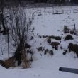
- Willow was planted along the banks of the stream channel to help reduce erosion along the stream banks and increase slope stability.
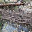
- Beaver Dam Analogs (BDA’s) were installed at various locations throughout the reach to help slow water and trap sediment to help reduce and reverse the incision of the channel
- A bridge will be installed to allow access by the landowner to his fields on the other side of the Creek. A bridge will provide access without impacting the Creek, and prevent additional sediment deposition from additional culvert installation attempts.
- A bridge was installed to allow access by the landowner to his fields on the other side of the creek.


